Route 66 is perhaps the most culturally iconic road in American history. Not to take anything away from other byways, but how many have had TV shows and become tourist destinations?
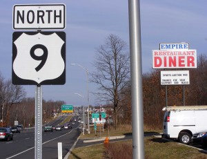
New York has its share of numbered roads with historic connections. In Westchester County where I live there is Route 1 (the Boston Post Road into New England); Route 9 (the Albany Post Road from NYC to Montreal), and Route 22 (the White Plains Post Road to the Canadian Border). These roads follow the lay of the land and have been used for centuries. We should be promoting them as access points to our history community.
In a recent newsletter, Town of Amenia historian Arlene Iuliano wrote about Route 22 as the middle path through Amenia history. She reports that the venerable road is straighter today than it once was when it more closely followed the contours of the land. The old road, perhaps not surprisingly, is called “Old Route 22.” The road today provides a quicker route but at the expense of the historic sites in the town which are now bypassed.
The Hudson Valley Historic Pathways has now created the “Hoof, Foot, Road, and Rail” pathway along Route 22 in Pawling, Dover Plains, Amenia, and Northeast, the Dutchess County towns along the Oblong that was contentious terrain with Connecticut. Some of this effort grew out the Dutchess County History Conference which I held in 2011, a brown bag luncheon in Pawling, and a meeting with Arlene in Amenia. Valerie LaRobardier of Dover Plains, who attended the Dutchess County History conference, was instrumental in this effort. The group has produced a color-coded map with four stops in each town. The next step is to create a scheduled program for tour operators or those wishing to experience Route 22 history.
Transportation is history. I like being on Route 5 and knowing that the King’s Highway, the Erie Canal, the railroad, and the interstate are in walking/swimming distance of each other as all of them cut through the Mohawk Valley.
Here in Westchester we have parkways, the ways through the parks that follow the rivers like the Hutchinson River Parkway, the Saw Mill River Parkway, and the Bronx River Parkway. My grandfather drove the Bronx River Parkway with my mother when it really was a excursion to the country as a Sunday drive. My father took me to the opening of the New Rochelle exit on the New England Thruway (I-95) when it cut through the middle of the city. Interstates are like that. They are impositions on nature by people as an act of conscious will and woe to the neighborhood or hill that is in the way. The interstates don’t have the historical cachet that the older roads do; they are for getting somewhere fast and easy, with no contact with the local communities. The old routes are part of the fabric of the community.
Wouldn’t they make great paths? How hard could it be to go to a tour operator and say: “Follow this road and stop in every community along the way to experience its story?” Of course, the local communities would have to organize to tell the story in a coordinated way for this to work Isn’t that exactly what Western New York put in its recent economic development proposal?.
So here is yet another challenge:
Let’s create “On the Road Again” paths for the leading roads in New York State.
Let’s have the municipal historian and historical society of each community on the historic roads of New York State create the local experience program.
Let’s then combine these community experiences into a larger experience called a path.
Photo courtesy Wikimedia user Jason Layne.


One great trip you left off was Rt 20, heading west out of Albany thru “Indian territory.” The NYS Thruway replaced it, but never removed it, and there it stands today, passing thru many old American Rev / Mohawk Valley sites such as Cherry Valley, only a few miles from Albany, but the beginning of what was the “Western Frontier” of the mid 18th century. THAT was really the original “Wild West.”
Bob,
Route 20 was in the original post which I submitted for publication. Here’s what I had:
New York has its share of numbered roads with historic connections. In Westchester County where I live there is
Route 1 the Boston Post Road into New England and not I-95
Route 9 the Albany Post Road from Broadway and points north and not I-87
Route 22 the White Plains Post Road and points north
There are numerous other roads which come to mind:
Route 6 and not I-84
Route 17 and not I-86
Route 20 and not I-90
Notice a pattern? These roads follow the lay of the land and sometimes have been used from the proverbial time immemorial.
I wanted to contrast the construction of the interstates with the contours of the ancient roads. yes, Route 20 which has an association of historic sites dedicated to it would make an excellent Path though History.
Peter
There is a book about Route 20 – ” Through the Heartland on U.S. 20 , Western New York, a Historical travel Guide” vol.III by William E. and Mary E. Lewis. This covers New York from Skaneateles to Ripley and the state line. The first two volumes cover Massachusetts and Eastern New York.
The authors had to choose between Route 20 and Route 30 because they could only do one. Route 20 was more “pristine” – it seldom linked with a highway.
Although the book was published in 2011 and a few things have changed the Lewis’ have captured the small town feel of Historic New York. I don’t know if there are other book that cover the rest of Route 20 to Oregon but this one covers western New York.
Try the old Susquehanna Turnpike, from Catskill Landing to Unadilla, on the Susquehanna River. (Sometimes called the Catskill Turnpike because the mileposts all state the distance from Catskill, which was mandated in the original charter circa 1800-1804. The actual Catskill Turnpike picked up in Unadilla and continued west to Bath, NY.). The turnpike runs from the Hudson River up through Durham to Conesville and Gilboa and on into Stamford, then through Harpersfield and West Kortright to Meredith, Franklin and into Unadilla. It is a great day trip, beautiful scenery and historic buildings. Some stretches of the current road follow the old turnpike, straight as an arrow through the hills.
I live in Ulster County, and for my day trip, drove up Rt. 28 (another great drive) to Delhi, then down Rt. 10 to just east of Deposit, where I headed north on Rt. 8 up to Sidney, then east on Rt. 7 into Unadilla, and right down Main Street to Wattle’s Ferry, where the original Susquehanna terminated. Then I continued on Rt. 7 to Rt. 357 towards Franklin where I picked up the route of the Susquehanna. The rest of the trip was on roads that either were part of the original Turnpike, or at least followed the route closely.
I reccomend this trip to anyone who likes to get out on the old roads and see New York as it was.
OK, Route 66 had a TV show and Route 20 is awesome but Route 28 has a book. Yes, Rob Scharpf wrote a book called Route 28: A Mile-by-Mile Guide to New York’s Adventure Route. Admittedly, it is a bit out of date now but it wouldn’t be that hard to update since many of the sites are right where they were in 2000 and every bit as fabulous as ever. I am on my third copy of the book, having given a couple away and I recommend it to everyone. Route 28 ROCKS!
Addie, thank you for buying three(!) of my books. It was a lot of hard work to research it and publish it, but much fun, very interesting, and very educational. (Don’t believe the sites (e.g., Amazon) that say that my book was published by North Country Books. I self–published it, forming a business called Big Pencil Publishing. (As a sixth-grade graduation present I was given a two-foot-long pencil “for when Robbie writes his book.”) See the Library of Congress entry here: http://lccn.loc.gov/98093247
I wrote the book because I was entralled by this very interesting road, the only one that goes through the middle of the Catskills and the middle of the Adirondacks. As you said, “Route 28 ROCKS.”
Rob Scharpf, 2/12/2015
I think it’s a shame to overlook New York’s own (State) Route 66!
I got captivated once, driving down 66 through Chatham (barely 15 minutes east of Albany), and losing myself in rural scenery and quaint delights. I kept passing up opportunities to cross the hills to the speedier Taconic Parkway, which is real pretty but doesn’t reveal villages and towns.
Peter Feinman is absolutely right that the difference is in the story each place can tell. Of course, the Parkway, and its adjoining forests and bogs, do have stories of their own. But the stories of people, history, pioneers and families are what really enrich these byway journeys.
Where can we get a copy of the “Hoof, Foot, Road, and Rail” map? I do not see one online.
I am not sure if Hudson Valley Historic Pathways is a legal entity or not. The mailing address is
Harlem Valley Historic Pathways
52 Mill Street P.O. Box 478
Dover Plains, NY 12522
This address and email address also are on the brochure.
Valley Independent
Media Group 201 3
P.O. Box 393
Wingdale, NY 1 2594
rpreilly@verizon.net
The village and town historians in Pawling, Dover Plains, Amenia, and Northeast, should have them.
Peter
And don’t forget Route 31 running East and West in Central New York and right through the middle of the Town of Clay. It was an Indian trail, the way West after the Revolution and now is being widened in various places to six lanes to accomodate Shopping Malls!
Dorothy
I remember my mother talking about the trips to visit her uncle in Massachussetts … the entire daylong journey on the Boston Post Road. (never referred to by its route number. Never.) I found it very easy to remember how to get around New Rochelle – the roads were named after the place to which they led. New Rochelle Road was in Eastchester, Pelham Road was in New Rochelle, etc. It made perfect sense to me.
Read William Least Heat Moon’s book Blue Highways to find a kindred spirit, someone who loves to stay off the interstate and poke around the communities that criss-cross America on ‘back’ roads.
As for Long Island, well, we have North Country Road (Rt. 25A), Middle Country Road (Rt. 25) and South Country Road (Rt. 27A), for the most part. If you’re into strip malls and gas stations, these are the routes to take eastbound out of the NYC limits through Nassau County. It gets somewhat better the farther east you go through Suffolk County and finally in eastern Suffolk we finally regain much of the appearance of our once quaint, charming towns…
Zak
I’d like to suggest that musical trails be mapped out in NYS as they do in North Carolina and other states. There could be a rock trail or Dyan, Loving Spoonful, etc, a folk trail for Seeger, Camp Woodland, etc., a classical trail, a jazz trail.
There are too many to count that are great byways: Rt. 30 through the western Adirondacks, Cherry Valley and the Delaware Water Gap; Rts. 67 and 29 crossing through four east-central counties; Rt. 313 connecting Washington County and Vermont along the Battenkill; Rt. 22-the old “moonshine trail” running from Westchester County up the eastern spine of the state to the Canadian border; the “Mohawk Trail” connecting eastern NY with Western Massachusetts [recently featured in the New York Times Travel Section]; Rts. 8, 28 and 28N running through the heart of the Central Adirondacks; Rt. 73 through the “ice cliffs” in Keene Valley, Avalanche Lake and on to Lake Placid. It goes on and on- “if only the roads could talk.”
I have been touting this same initiative for years, based on the National Park Service’s attempts to restore historic buildings and communities along Route 66. Why not the Tom Quick Trail or the Liberty Highway?
THE LIBERTY HIGHWAY IS BORN
The automobile has long been part of life here in Sullivan County.
As far back as 1898, for example, there was a booklet entitled “Road Maps of Sullivan County: Showing the Good Roads.” Of these roads, it was said that “many of the Sullivan County roads are turnpikes, maintained by a chartered company. They are made of shale rock, and are hard and springy.”
Of course, more of the folks riding on those “hard and springy” shale roads in 1898 were likely to be riding bicycles than driving cars, but that would change before long. By 1909, groups touring the area in cars, known popularly as “automobile parties,” were becoming commonplace at Sullivan County’s many hotels.
Sullivan County’s most renowned link to the automobile was established a few years later. Motorists traveling between New York City and Cleveland, Ohio in the early years of the 20th century invariably took one of two routes. They drove either the Mohawk Valley route, through Albany, Syracuse and Buffalo, or they traveled the historic Lincoln Highway, through Philadelphia and Pittsburgh.
That all changed in 1918, largely through the efforts of a man named R.H. Johnston, who almost single-handedly brought national attention to the road he began calling the Liberty Highway.
Johnston was the New York branch manager of the White Motorcar Company– of which he would later serve as chairman– when he needed to get a large fleet of trucks from the automaker’s Cleveland factory to New York City. Both of the popular routes were clogged with U.S. Army vehicles on their way to New York for transport across the pond to France. After studying a number of maps of the area, Johnston devised an alternate route that took him from New York to Monticello, Liberty, Binghamton, Elmira, Hornell, Olean, Jamestown, Westfield, and Erie.
After driving the route himself, he wrote a lengthy article about his journey in the popular weekly automotive magazine “Motor Age,” which appeared in the April 4, 1918 issue.
“The new route from New York to Cleveland is about 585 miles long,” he wrote. “This is about 80 miles less than the Mohawk Valley route and is only about 30 miles longer than the Lincoln Highway route. Owing partly to the spirit of the times, and partly to the fact that the tourist setting out from New York over the new route makes his way toward Liberty, N.Y., it seems to me that the new route should be known as the Liberty Highway and I will so designate it here.”
The publicity didn’t stop there.
“Mr. Johnston reports that he found his route in good condition all the way, and from every point of view it is preferable to either the Mohawk Valley trail or the Lincoln Highway,” the Sullivan County Republican newspaper noted on May 3, 1918. “A distinguishing feature of the Liberty Highway, aside from the excellent condition of the roads, is the splendid scenery which it unfolds to the tourist. Most of the time the route follows several valleys which characterize the Southern Tier counties. The road winds picturesquely through these valleys following the water courses.”
Both the Republican and the Liberty Register ran front page stories about the highway, reproducing a promotional mailing sent out by White. Before long, other car companies were following White’s lead and making use of the new route. Harry J. DeBear, manager of the New York Maxwell Motor branch, routed his new cars from Buffalo to New York along the Liberty Highway, and officials from Buick and Hudson also utilized the route.
Then Johnston hired a film maker to travel with his vehicles and record the beautiful scenery along the way for use in a promotional film.
“The camera crews were received with great enthusiasm by the Business Men’s Association of Liberty and Monticello and by the public in general,” Manville B. Wakefield writes in his 1970 book, “To The Mountains by Rail,” “and more than six hundred feet of film out of the several thousand taken over the entire southern tier were shot in Liberty. The completed film, greeted with appropriate parades and hoopla, was shown to enthusiastic Sullivan County audiences.”
The film brought national attention to the area. The Liberty Highway Association was formed to further publicize the route, and it proved to be a worthy successor to the O&W Railroad as the chief promotional organization boosting “the mountains.”
In 1923, the New York Times called a drive along the Liberty Highway between New York City and Binghamton, “a pleasant weekend trip,” and as the popularity of the automobile grew throughout the ‘20s, the route became one of the most popular ways to reach Niagara Falls, which the Times called in its June 17, 1928 edition, “the objective of more vacation tours than any other scenic spot in the Eastern United States.”
By 1930, State Route 4 had been re-designated Route 17, and was largely reconstructed. Still, as the Sullivan County resort industry boomed, even those improvements proved inadequate. A survey in 1932 revealed that more than 88,000 cars used the two lane roadway in a twelve-hour period. The resulting congestion prompted local officials to call for a new, larger highway, and after more than twenty years of trying, they finally succeeded in getting the Quickway built. By the time Governor Averell Harriman officially opened the new road in 1958, the Liberty Highway was but a distant memory.
This week John Conway celebrated his 20th anniversary as Sullivan County Historian. He can be contacted via e-mail at jconway52@hotmail.com.
Cayuga County Coalition of Museums and Historical Societies (H3C) have a tentative plan for 2014 to do two day-long bus tours (North & South that will include Routes 34, 38, 31 and 90) in Cayuga County. This will depend on the amount of commitment we can get from the local small countryside museums to help with the project. It seems almost every historical society group in our county coalition is struggling right now having enough help with managing programs and volunteer participation.
We need help on how to build our volunteer and membership base because our older members are getting tired and burned out.
Cheryl:
Have you considered applying for a room tax grant, or doesn’t Cayuga County have them. In Tompkins County the museums and History Center get generous awards from the room tax money. Certainly, a two-day trip could be considered tourism if advertised and conducted properly.
Thank you for your suggestion. I will check into it!
Peter,
Great blog and captivating comments! The Automobile Museum is currently discussing an exhibit that would feature a historic NY roadway along with our Racing in NY exhibit and Made in NY exhibit. Please don’t hesitate to forward any information over our way!
Seth
Director of Education
Saratoga Automobile Museum
110 Ave. of the Pines
Saratoga Springs NY 12866
Although route 5 sometimes joins up, route 20 from Albany westward is my favorite. I regularly take it to Rochester. However, I’d just as soon not publicize it as almost everyone opts for the parallel Thruway in lieu of the many small towns, restrictive speed limits and traffic lights, meaning I can enjoy the countryside in peace.
By the way, I was lucky to have travelled the entire original route 66 in 1948 when going to visit family in California. It was a wondrous trip for a child old enough to still remember all of the details. No heavy civilian traffic then – mostly i remember transport trucks and eating at roadside diners with the drivers. I believe I still have a box full of material collected along the way.
I also have several NYS “route books” which I can’t locate at the moment.
Check out the Mohawk Towpath Byway. It follows the historic water level route west, the only water level route through the Appalachian Mountains. The Byway follows the historic route of the Erie Canal between Waterford, Cohoes and Schenectady. As one travels the route you discover the role our communities played in the westward expansion of the country and in the Industrial Revelution.
The Mohawk Towpath Byway is a New York Scenic Byway and one of America’s Byways®, a network of 150 unique national byways. Check out our new audio tour service at 518-649-9990.
Peter,
Your post seems to have completely overlooked some of the great work already being done by Federal and State Scenic Byways across the state. Everything you have proposed, byways, such as the Lakes to Locks Passage, Mohawk Towpath and Seaway Trail, are already doing, and much much more.
Your Proposals:
“Follow this road and stop in every community along the way to experience its story?
Done!!
Let’s create “On the Road Again” paths for the leading roads in New York State.
Done, but by a different name.
Let’s have the municipal historian and historical society of each community on the historic roads of New York State create the local experience program.
Done!!
Let’s then combine these community experiences into a larger experience called a path!
Done!! Except we don’t call it a “path,” we call them “Byways!!”
I urge you to read up on the existing management and interpretive plans on scenic byways, and those that already exist in your communities!! Lets support these existing programs. Not create new ones!!
Here is our strategy, which is endorsed by the Dept. Of State, NYS Archives Partnership Trust and the Institute of Museum and Library Services:
http://files.lakestolocks.org/portal/ltlDJT843IFV95342790/pdf/content/ltl8C79D155F03BC4C9B.pdf
Andrew is absolutely right! Also check out http://www.adirondackscenicbyways.org — Great content; sadly no additional funding was made available to keep site fresh and up-to-date, and to add additional Adirondack North Country Scenic Byways. Many of the Adirondack North Country Scenic Byways also have Corridor Management Plans which have been approved by NYS DOT that have scads of ‘pathway’ info.
Thank you Susan and Drew for your comments. You may wish to reread my post to New York History on September 13, 2012, Path Through History: An Historical Perspective. The picture used to illustrate the post was the map of the Scenic Byways in the state. The post mentioned a number of existing “paths” which the new Path through History seemingly ignored. Among other references, the post mentioned the Schenectady County-Mohawk River Blueway Trail Plan, New York State and National Scenic Byways program with 20 trails, paths, and byways, Route 20, . the Seaway Trail, and Lakes to Locks Passage.
Drew writes that my “On the Road Again” path suggestion has been done already except they are called “Byways.” That was exactly the point of the post last September and why I have been so critical of the Path through History project. I deliberately used the word “path” in this post because that is the required jargon today. And there still is no place for a path/trail/byway/route on the Path website.
But let me close with a comment I have made several times to you Drew: all these journeys are self-guided. There is no program one can give a tour operator, a bus company, or a group of teachers. The common denominator is everyone is on their own to create their own path but as I also have written about in previous posts, that really doesn’t help a group looking to go on a bus tour. I know, Drew, that you have tried on several occasions to get people in your area more involved in planning something more organized and I know no matter how many times you have connected me via email to various people nothing has ever come of it.
If the Path project was serious about promoting tourism in the state it would inventory the present trails, byways, drives, routes and historic roads, facilitate the creation of scheduled tours on them, and list them on its website. But as we near the one year anniversary of the Path project, we all know that nothing like that will happen and there is no leadership from Albany on the project.
If anyone accepts Peter’s challenge to create “On the Road Again paths . . . [or] local experience program[s] for the Hudson Valley, please share them with Teaching the Hudson Valley. We have a network of teachers who might be able to use them and we could consider them for broader sharing on our website.
My first project in 1972 as a student at SUNYA was relocating the old King’s Highway between Albany and Schenectady and in 1975 I erected 25 Historic Markers along that route, all but one still there. Nice that people are realizing now that historic roads are important too. We have historic toll roads and of course the New Netherland Road (RT 9) once a Native trail.
What Are the Historic Byways of Albany County?
I don’t know if this was intended as a question or not, but the most historic road in Albany County was King’s Highway, the road from Albany to Schenectady. Today it is State Street in downtown Albany, Washington Avenue from the Capitol to near Schenectady County and then Kings Road in Schenectady. This took all the commercial traffic from the early 1600s to about the time of the Erie Canal. The Iroquois Indians used this path prior to the 1600s to travel by land to Albany and South on the Hudson.
King’s Highway was then replaced with what was supposed to be the widest and strongest and heaviest travelled road in the US – State Road or Albany – Schenectady Turnpike, now State Street in downtown Albany – Central Avenue (rt. 5) outside the downtown area – State Street in Schenectady County. It brought traffic from the Mohawk River at Schenectady (going around the Cohoes Falls) to Albany and then to the port of Albany for shipment down the Hudson.
When you came from the port of Albany, up State Street, at the top of the hill near the Capitol you could branch left and follow the Western Turnpike (Western Ave.) rt. 20 west all the way to the west coast. Or you could bear right and follow Washington Ave (King’s Highway) to Schenectady and pick up the Erie Canal at Schenectady.
Hundreds of thousands of migrants moving west in the 1700s and 1800s took rt. 20 from Boston to East Greenbush (East Albany), then the ferry to Albany’s port (the first ferry in the USA -built originally by the Van Rensselaers about 1640), then one of the routes mentioned above. One of my old books mentions hundreds of wagons and hundreds of cattle moving up State Street in Albany on a warm summer day headed west.
For more information look for “Ocean to Ocean on Horseback” by Willard Glazier about 1870.
The military Post Road from downtown Albany along the Hudson River to Saratoga and Lake George is almost as important. It brought troops from the Albany Port to Lake George during the French and Indian War and later the Revolutionary War – Battle of Saratoga. Schuyler travelled this road frequently going to his farm at Schuyler Flatts and further to his logging and lumber mill at Schuylerville. Benjamin Franklin travelled this road just before the Revolutionary War travelling to Canada to ask his friends if they wanted to join us in opposing the British.
The Albany Shaker Road is also interesting as it ran from the Patroon’s House just north of Albany to the Shaker Farms which was the grocery store of its time.
Broadway was the location of the Stadt House, the meeting house where Franklin presented his Albany Plan of Union, The Dutch Church was located in the middle of the intersection of Broadway and State (then Yonkers and Handelers streets). Pearl Street, one block up from and parallel to Broadway, was the location of the first Schuyler home and the bakery made famous for the story The Baker’s Dozen. Broadway in New York and Broadway in Albany and Broadway in Saratoga are all the same street (rt 9).
It is pretty sad that the Adirondack Scenic Byways web site is starving to death for lack of funding, local participation, and maintenance. Although a group in my area apparently took responsibility (they are named on the web site) apparently they thought their job was over when they put up the signs marking the Scenic Byway. When I moved here recently I walked around asking people “What are those signs?” because there is no text, just an icon that is related to and seemed to indicate directions to a local business until I noticed that 1/2 the signs faced in the opposite direction.
As Dorthy Heller said Route 31is a great road. It runs east and west along the shores of the Erie Canal. It provides scenic access to the many quaint Canal Communities.
In Wayne County, in the Town of Galen there is a section of the original Route 31that is still used today. If you travel this road you will find farms, wild life and Blackbrook Park which will give you access to the tow path along the original Erie Canal bed. Bring your bug spray you will need it if you would like to walk the trail.
If you walk west along the trail you will find yourself in Lock Berlin Canal Park where there still is part of the old Canal with an enlarged double lock still standing.
If you walk east the trail will eventually end and you will find yourself on Old Route 31. You will enjoy the generally peaceful road which will lead you to the outskirts of the Village of Clyde where you will again find another set of double enlarged locks and today’s Route 31.
Enjoy the trip if you go! A great fall walk for sure and wonderful cross country skiing.
Hi Peter
Could you locate some information relating to the Old Tower Hill Road in Amenia. I have found it on a deed and would like to know more about it.
Thanks
Marvelous comments all and hark back to that wondrous time of my youth which spanned that great motoring period either before the interstates or before the interstates were competed.
Those wonderful upstate New York automobile trips made with my father, mother, grandmother, and later, my younger brother, were simply grand. Seemingly new Burma Shave signs dotted the roadways, many of the back roads were simply oiled gravel, others were dirt roads. And they seemed to stretch for miles without another car to be seen.
My father, a salesman for Fuller Brush for awhile before he hit the big time, seemed to know where the easily accessible springs were. We’d pull over, turn off the auto, in the shade if possible, and the old man would open the glove box and retrieve his collapsible drinking cup. And we’d walk over to the spring, often a pipe sticking up out of the ground with a squeeze clamp to control the flow, and drink some delicious artesian well water. All out in the silver sunshine, somewhere only my old man knew about, with the women folk in dresses, grandmother sporting her white gloves and a tidy Chanel hat, mom a bit more sporty with her hair back in a bow, in loose slacks and loafers, the old man in his tan and white spectators, cuffed khaki slacks, and open button down dress shirt, sunglasses, and a pipe, lit or not, clenched between his feet as it had probably been on the bridge of his ship at Normandy on June 6, ’44. My kid brother and I, flanking my grandmother in the backseat, dressed as we did then: Jeff in a hand me down somewhat faded polo shirt and jeans with sneakers, while I sported a newer Lacoste polo shirt, chinos, and Weejuns without socks.
The back roads of upstate New York provided marvelous adventures. My mother used to drive out to Buffalo on back roads through the Finger Lakes and we’d marvel at the remains of Sampson Naval Base, its size and complexity, and wonder how something so large could fall into to disrepair so quickly. On these trips, as navigator, I was shocked to find that the crystal clear waters of Hemlock Lake, well, according to the beer ad, were less so.
The beauty of New York, mile after mile in it’s real heartland, where you’d pass people doing chores, working the farm stands, visiting each other, sitting on porches, having parades, watching ball games of every sort, see folks wave to you, pass couples walking hand ind and know that it would be you someday, and see firefighters and cops, and state troopers, it was all heartwarming and heartbreaking at the same time.
After one of the last trips we ever took I remember, I began to cry as I lay in bed. I was wracked by long sobs which I just couldn’t stop. I had somehow been deeply effected by a woman at a farm stand speaking with her husband, an obvious farmer, as they changed the guard at the stand, and something turned within me at that sight. She was going back in the twilight to work the farm while he worked the stand. Oh, how I cried at the thought of such seemingly endless toil. Then my mother came in and we talked it all out. I was eleven, the next year we would move to a big house in the country, a whirlwind of excitement would overcome me, football, wrestling, scholarships in sports and academics.
Today is my 64th birthday. But I still treasure motoring those back roads with my folks. Awe were always happy, it was always sunny, the Burma Shave signs beckoned to a later stage of life, the shadows were so clearly defined by the roadside wells, and the wind blew the leaves enough to show their lighter sides which meant that rain would be coming later.